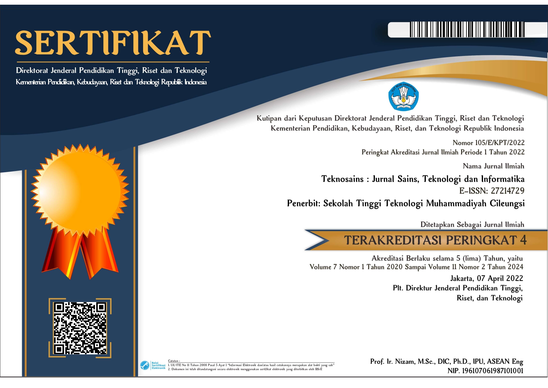
Geographical information system for garbage collection in sanggau city and shortest path using dijkstra’s algorithm
Abstract
When trying to find the closest facility, citizens frequently encounter difficulties due to the dispersion of waste collection facilities at different areas. Therefore, it is essential to offer a tool that can help the general public locate the nearest rubbish collection site. The goal of this study is to create a geographic information system for garbage collection locations and to use the Dijkstra algorithm to find the fastest route to the closest facility in the city of Sanggau. For locals to have simple access to information, this system will employ freely available resources like the Google Maps API. The system development process will make use of prototyping. According to the results, Sanggau city residents can use a geographic information system to find garbage collection locations and to speed up their search for the quickest way to the closest facility
Copyright (c) 2024 Reyhan, Rachmat Wahid Saleh Insani, Barry Ceasar Octariadi

This work is licensed under a Creative Commons Attribution-NonCommercial 4.0 International License.